Nearly 300,000 Nepalis at flood risk: study / Photo: PRAKASH MATHEMA - AFP



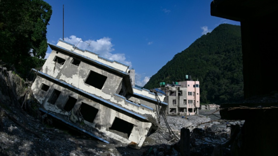
More than 1,400 people were killed and 5,000 remain missing after catastrophic floods hit Nepal in August -- and a new study Thursday warned nearly 300,000 people face similar risks.
A tsunami-like wall of water and debris triggered by a glacial and rock collapse on the Nepal-China border on August 26 cut a swathe of destruction across the nation.
The disaster raised fears that similar floods could strike elsewhere as glaciers retreat and development expands across fragile mountain terrain.
The study, published in Scientific Reports, examined areas up to 50 kilometres (31 miles) downstream of 1,361 Himalayan lakes in Nepal and neighbouring parts of China and India.
"Our results demonstrate rapidly increasing exposure in Himalayan catchments," key study scientist C. Scott Watson, from Britain's University of Leeds, told AFP.
Scientists say climate change played a key role in the August floods.
Nepal, a country of around 30 million people that contributes only a fraction of global greenhouse gas emissions, estimates reconstruction will cost $4.78 billion.
Prime Minister Balendra Shah told the United Nations last month that the flooding "was a warning to the world" about the rising dangers of climate change.
The study estimated 293,000 people live less than 50 metres (164 feet) above usual water flows, putting them potentially within reach of floodwaters.
And the area covered by buildings in potential flood zones increased by nearly 46 percent between 2016 and 2023, the study found.
In the Himalayas, where rivers drop rapidly in height, giving them staggering power, even small changes in temperature or rainfall can have "disproportionate impacts" downstream, it added.
"Hazards are increasing as glaciers retreat, glacial lakes form and mountain permafrost thaws," Watson said.
"It was only last year that a smaller-scale glacial lake outburst flood, with associated fatalities and infrastructure damage, struck the same river channel as the recent August 26 disaster," the scientist added.
"The next step is to develop detailed hazard maps that we hope can inform land-use planning, infrastructure development and early warning systems."
O.Lindberg--StDgbl